Research

Our research

Our program examines how a changing climate shapes population health, organized around four connected themes. We link high-resolution exposure data to large surveillance, clinical, and administrative datasets, and partner with agencies and communities to deliver actionable evidence.

Theme 1

Climate epidemiology of fungal diseases

Establishing the environmental drivers of climate-sensitive fungal infections — and building the tools to forecast them.
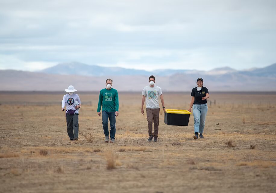
Field team sampling in an arid California landscape

Over the past six years, our work has helped establish the climate and environmental drivers of coccidioidomycosis (Valley fever). We have shown that precipitation volatility, hydroclimatic swings, and drought-to-wet cycles drive California incidence, and we have produced forecasting tools now used in partnership with the California Department of Public Health.

Hydroclimate and Valley fever risk

In a study of California surveillance data (The Lancet Regional Health – Americas, 2024), we used wavelet analysis to show that drought followed by wet conditions is linked to anomalously high seasonal peaks — work covered by The Washington Post, the San Francisco Chronicle, National Geographic, Science, and KQED. Building on it, we co-led an ensemble forecasting model integrating hydroclimatic data to predict near-term incidence (Emerging Infectious Diseases, 2025); its forecasts informed CDPH public warnings ahead of high-risk periods.

Land use, dust, and disease

We led an analysis linking Valley fever incidence to natural, agricultural, and fallow land covers across California (accepted at Science Advances). As the Sustainable Groundwater Management Act accelerates farmland retirement, identifying which land transitions elevate disease risk can guide dust-control requirements, safer timing of soil-disturbing activities, and targeted protection of nearby communities.

Extending the program

Through a partnership with the Arizona Department of Health Services — where reported cases have doubled since 2013 — our first joint publication (MMWR, 2026) documented substantial regional increases in incidence from 2005 to 2022. We have also extended to a second fungal pathogen as co-Investigator on an NIH R21 (led by Dr. Jennifer Head, University of Michigan) studying how temperature, precipitation, and land-cover change drive blastomycosis emergence. To support this pipeline we secured an NIAID R21 on ambient dust and extreme dust events and Valley fever in Arizona, along with CAFE and UCSD Senate pilot grants.

Theme 2

Mineral dust and extreme heat

Quantifying the health effects of an underrecognized and rapidly growing hazard across the western U.S.

Dust storm frequency in the Southwest has risen roughly 240% since the 1990s — driven by warming, drought, and the expansion of bare ground from fallowed farmland and shrinking lakes — yet only a handful of U.S. epidemiologic studies have examined dust-specific health effects. We built an externally funded initiative, anchored by an NIEHS K01 and a California Air Resources Board contract, to close that gap.

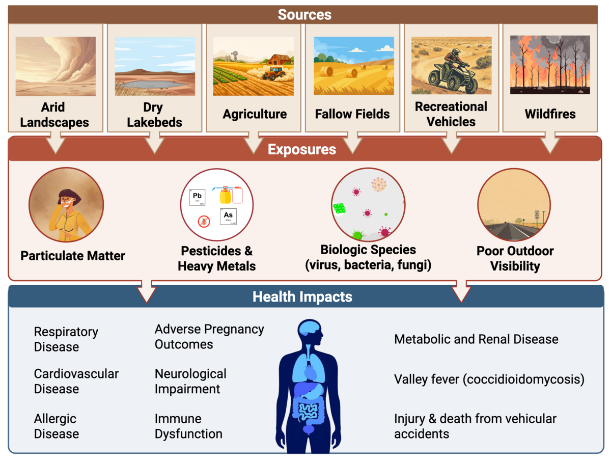
Infographic showing sources, exposures, and health impacts of mineral dust

Prenatal dust, heat, and birth outcomes

Our NIEHS K01 supports a statewide investigation of how prenatal exposure to mineral dust and extreme heat affects preterm birth and low birth weight, using the Study of Outcomes in Mothers and Infants (SOMI) cohort of more than 7 million California births (2000–2023), distributed lag nonlinear models, and new high-resolution dust exposure databases to identify windows of vulnerability and quantify joint dust–heat effects.

Dust from the shrinking Salton Sea

Our CARB project investigates how dust from the shrinking Salton Sea affects human health. We lead the health-impacts arm — quantifying associations between source-specific dust and emergency department visits, projecting future burdens under emission scenarios, and identifying the most-exposed communities. A manuscript on dust exposure and birth outcomes in the region (n = 126,336) finds that prenatal dust exposure elevates risks of preterm birth and preeclampsia, concentrated in the second and third trimesters.

Methods that scale

To run these analyses at scale, our group developed GAVE, a raster-free method for buffer-based exposure assessment that runs roughly two orders of magnitude faster than conventional workflows (Environmental Research, 2026). We also contributed to Beyond the Haze: A UC Dust Report and to work showing that land fallowing in the Central Valley is a dominant driver of anthropogenic dust (Communications Earth & Environment, 2026).

Community-engaged research

Community engagement anchors this theme. In the Eastern Coachella Valley we partner with Unidas por Salud and its promotoras; in the Imperial Valley our CARB-funded team collaborates with Los Amigos de la Comunidad in Brawley. Together we are co-designing a mixed-methods study of heat and dust risk perceptions and adaptation behaviors among pregnant residents, with data collection anticipated in Fall 2026.

Theme 3

Climate, active transport, and health

How climate shapes active transportation — and what that means for urban health, equity, and resilience.

Physical activity is one of the best disease-prevention strategies, and it is shaped by temperature, precipitation, and air quality. We study how climate change affects active transport, which both mitigates emissions and promotes health.

A cyclist riding in a protected bike lane in a city

A global view of cycling and climate

We are leading a comparative analysis of more than one billion trips from 44 bikeshare systems across North America, South America, Europe, and Asia, evaluating how temperature, precipitation, and humidity shape cycling across climatic, cultural, and infrastructural contexts — and which local design and policy factors buffer those impacts.

Wildfire smoke and behavior

A study using 330 million bikeshare trips from 12 U.S. cities (2010–2023) shows that cyclists do not habituate to recurring wildfire smoke — behavioral change amplifies with cumulative exposure. Building on this, we established a binational collaboration with Tecnológico de Monterrey to study how extreme heat and urban infrastructure affect cycling in Mexican and U.S. cities, integrating bikeshare data with a computer-vision audit of greenery and cycling infrastructure from street imagery.

Climate action and equity in cities

Our collaboration with Dr. Deepti Adlakha (TU Delft) and Dr. Jim Sallis (UCSD) on city Climate Action Plans produced a global research agenda for centering health and equity in city CAPs (PLOS Climate, 2026), with several follow-on manuscripts in development.

Theme 4

Hydrometeorological drivers of diarrheal disease

Linking climate variability to diarrheal disease in arid regions — and turning those links into forecasts that help communities prepare.

Diarrheal disease remains a leading cause of death in children under five, yet our ability to anticipate outbreaks is limited. Using unique under-5 diarrhea surveillance data from Chobe District, Botswana, we showed that incidence follows strong seasonal dynamics driven by local rainfall, river flooding, and surface water quality (PLoS Medicine). We then demonstrated an El Niño–Southern Oscillation (ENSO) teleconnection with southern Africa: La Niña conditions, lagged 0–5 months, are associated with cooler temperatures, higher rainfall, greater flooding, and higher-than-average under-5 diarrhea incidence (Nature Communications).

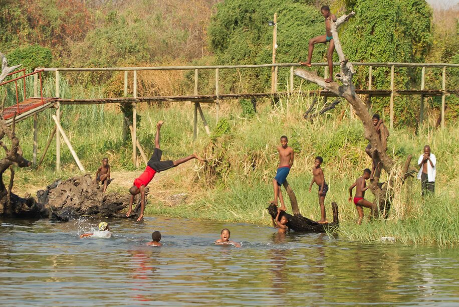
A river in the Chobe region of Botswana

Because ENSO data are publicly available, these relationships open a path to anticipating diarrheal outbreaks months in advance in low-resource settings — where deaths are largely preventable with low-cost treatment. We are now extending this work to Jordan as part of the Global Center on Climate Change and Water, Energy, Food, and Health Systems, linking administrative health, water quality, and climate data to diarrheal disease in another arid environment.

Developing and testing disease forecast systems

Building on these drivers, we developed and tested an epidemiological forecast system for childhood diarrhea in Chobe District, coupling a compartmental susceptible-infected-recovered-susceptible (SIRS) model with Bayesian data assimilation to infer epidemiological parameters and generate retrospective forecasts. The system accurately simulated weekly diarrhea cases from 2007–2017 and produced reliable forecasts up to six weeks before an outbreak's peak — often outperforming predictions based on historical trends alone. Reliable forecasts can help officials anticipate and mitigate outbreaks by informing vaccine distribution, clinic staffing, and supply management, and we are now applying the same system to forecast diarrheal disease in Jordan.

Want the details?

Browse our peer-reviewed publications, or get in touch about collaborations and student opportunities.